Monday, 15 April 2013

Glorious Landscape Images From Kedarnath Trek Route – Uttarakhand


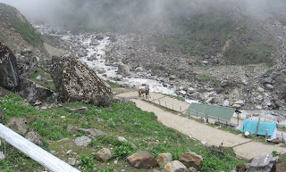
Among the Himalayan shrines at Garhwal region of Uttarakhand, the most satisfying for a Yarti is to foot it out all of 14 km from Gaurikund to Kedarnath. Having made the trek three times in last 25 years, it is not surprising that I posses a large collection of images taken at various stages of trek. For one, the arduous trek necessitates one to take a large number of breaks to get one’s breath back. What better opportunity can be there to click some frames of the glorious display of nature’s landscape largesse. Following 18 images selected from my collection from three treks to Kedarnath for sharing with my readers.

Frame 1: May 1984
Dawn breaks as we commence the trek

Frame 2: May 1984
Pilgrims’ Progress

Frame 3: May 1984
Cloud Rise at Kedarnath Valley


Frame 4: May 1984
Arrival at Kedarnath Valley 


Frame 5: May 1984
Return Trek 

Frame 6: May 2006
The Initial Trek Route

Frame 7: May 2006
Breather at Waterfall

Frame 8: May 2006
Half Way Through Trek Nearing Ramwada

Frame 9: May 2006
Ramwada Village A Close View

Frame 10: May 2006
Through Cloud and Mist


Frame 11: May 2006
Top View of Trek Route

Frame 12: May 2006
Top View of Trek Route

Frame 13: May 2006
Arriving at Garud Chatti

Frame 14: May 2006
Reaching Kedarnath Plateau and Dwelling

Frame 15: May 2007
Bridge Overlooking Snow – mass

Frame 16:  May 2007
At Ramwada – Lazy day for horses

Frame 17: May 2007
View at Ramwada – A picture post card view


Frame 18: May 2007
View at Ramwada – The Village

………………………………………………………………………………………………

Saturday, 9 March 2013

Tracking Flamingos’ Journey Through High Seas To Sewri Mudflats, Mumbai


This account of my experience of tracking Flamingos’ journey on 24th February, 2013, was not as per my intent but due to circumstances and some amount of luck. In my earlier visits to Sewri mudflats resulted in some videos and images of Flamingos and other migratory birds. For the present trip, as usual, I noted the high tide timing in morning to be at 11.15 am and decided to reach the jetty at 12.15 pm when Flamingos were expected arrive on mudflats with tide water receding. However, after reaching the site at 11.45 am, I realized that something had gone awry. The mudflat was fully engulfed with seawater with no birds at sight. There were a few first time visitors who came with anticipation to watch the Flamingos but disappointment writ large on their faces. The security personnel there informed me that in the morning around 7.30 am many visitors were at site and it was like mela. For me, there was no alternative but take shelter from hot sun in shade of security enclosure and mount my tripod and watch the Flamingos in high seas in LCD screen of my Handycam in maximum zoom setting. As time wore on, Flamingos advanced towards mudflats with tide water receding. In following photo essay, images are given frame by frame in different stages of Flamingos’ advance from high seas to mudflats. 

Frame 1 Time: 11.45 am
Flamingos congregated in deep sea, as seen through gap between two dilapidated fishing trawlers which are stuck in mud very close to jetty. In middle of the frame lies the pink colored band from end to end, with few hundreds of the lesser Flamingos packed very close to each other, swimming towards the shore.


Frame 2 Time: 11.46 am
A zoom image of a cluster of Flamingos in deep sea shows the Flamingos bobbing up and down on gentle sea wave and swimming towards the shore. Their long curved prominent red beak and pink body is conspicuous. The timing of their progress is so very calculated that they reach the mudflats when a large patch of it is devoid of tide water, making the place ideal for feed.


Frame 3 Time: 12.23 pm
It was rather boring for next 40 minutes with nothing to do but wait patiently for the Flamingos to advance. A high zoom shot at this point, the individual Flamingo could be seen distinctly and clearly, swimming in one file with Gulls flying overhead.


Frame 4 Time: 12.25 pm
As with anticipation we waited, something bizarre happened and Flamingos made an about turn to retrace their path towards deep sea.  We just realized a lone fishing boat with a lone fisherman had gone too close to the birds and frightened them away.

 
Frame 5 Time: 12.25 pm
The Flaminos take off from the water surface in unison, the sight captured in my Handycam will remain as my one of the most memorable footages.  The big birds at the moment of take off shows all the radiant pink and black color in their wings, the long legs fully stretched and body glistening by reflecting the harsh sunlight post noon, causing mini – turbulence in the seawater.


Frame 6 Time: 12.25 pm
The Flamingos make a semicircular turn in air and head towards another spot to enable them to take fresh positions in water to resume their routine of moving towards the mudflats.


Frame 7 Time: 12.26 pm
As the Flamingos moved out of range of my Handycam LCD, the fisherman who caused the exodus made his brief appearance with one of the last Flamingos to leave the scene. I mused, ‘The Flamingos will surely find a new location to settle dawn on sea water and continue with their ritual of moving towards the shore but it is not everyday one sees such a large number of Flamingos taking off in unison in mid-sea.’ I felt immensely lucky today and offered my silent thanks to the lone fisherman who unwittingly caused these flying moments to happen. 


Frame 8 Time: 1.09 pm
Having seen the Flamingo party disturbed, it was again a test of patience, waiting for the Flamingos to settle down in sea in new locations to commence their journey, which was getting delayed to our dismay. The two groups of Flamingos settled at two different locations and the one with a ‘Y’ formation looked attractive.


Frame 9 Time: 1.13 pm
It was few minutes later that I caught up with the Flamingos  who were moving pretty fast to make up for the lost time. They were into shallow water and no longer swimming. From their movement, one could say, they were walking although their body sans legs were only visible.


Frame 10 Time: 1.17 pm
A few minutes later the first batch of Flamingos reached very close to mangroves in mudflat with some of the birds flying overhead to keep up the pace with the group. The pink birds were now visible in full for a closer look.


Frame 11 Time: 1.20 pm
Zooming revealed, the Flamingo bunch was not the only species at the mudflats. There was a swarm of unnamed small birds and a Black headed Ibis busy with the same activity of picking food at regular intervals.


Frame 12 Time: 1.26 pm
Flamingos finally moved much closer and arrived at a spot where best possible view is available to the visitors. A final parting shot before we called it a pack up for the day.


* Author regrets that most of the images have been created from the frames of video clips and hence the clarity is lacking. The intent of this photo essay was to share my experience. Those readers, who desire to see this incredible Flamingos journey in best possible clarity on full computer screen need to click the following video link. Rest assured, they will not be disappointed. 
 
…………………………………………………………………………………

Wednesday, 6 February 2013

Captivating Snowscape Images From Uttarakhand


Uttarakhand state has many Himalayan destinations visited by devout and laymen. The Garhwal region of Uttarakhand has religious shrines namely, Kedarnath, Badrinath, Gangotri and Yamunotri, which everybody would like to visit at least once in their lifetime. Devoid of high altitude mountain passes, post winter, the destinations in high altitude regions above 8,000’ are accessible from first week of May. Hemkund route opens in first week of June. I have the pleasure of travelling extensively for last several years in various high altitude destinations of Uttarakhand resulting in large number of snowscape images. Some are posted as below.

Image 1 Caption: Way to Badrinath
Description: The most accessible of Char Dham shrines in Garhwal happens to be Badrinath with road connecting it from Rishikesh. The early summer visitors, around mid-May, will see accumulated snow en route at several locations with rivulet flowing underneath. The image was captured from a running bus as we were approaching Badrinath. 


 Image 2
Caption: Mt. Neelkanth at sunrise
Towering Mt. Neelkanth (6590 m) is visible from almost any spot at Badrinath. One needs to get up early in morning around 5 am and pray for a bit of luck so that clouds would not be obstructing the peak. The sunrise spectacle lasts for more than 15 minutes. Following still image is best I could get from my visit to Badrinath in early summer in May 2006.   


Image 3
Caption: Crumbling snow and the rivulet
Kedarnath is arduous 14 km trek beginning at Gaurikund. My three treks to Kedarnath has resulted in many still images and videos. The topography had a different look in each of the visits. Most memorable visit was in May 2007, when there was too much snow alongside the gorges on trek route after walking 7 km and nearing village Ramwada. In the frame the river Mandakini is flowing alongside a crumbling snow formation.


Image 4
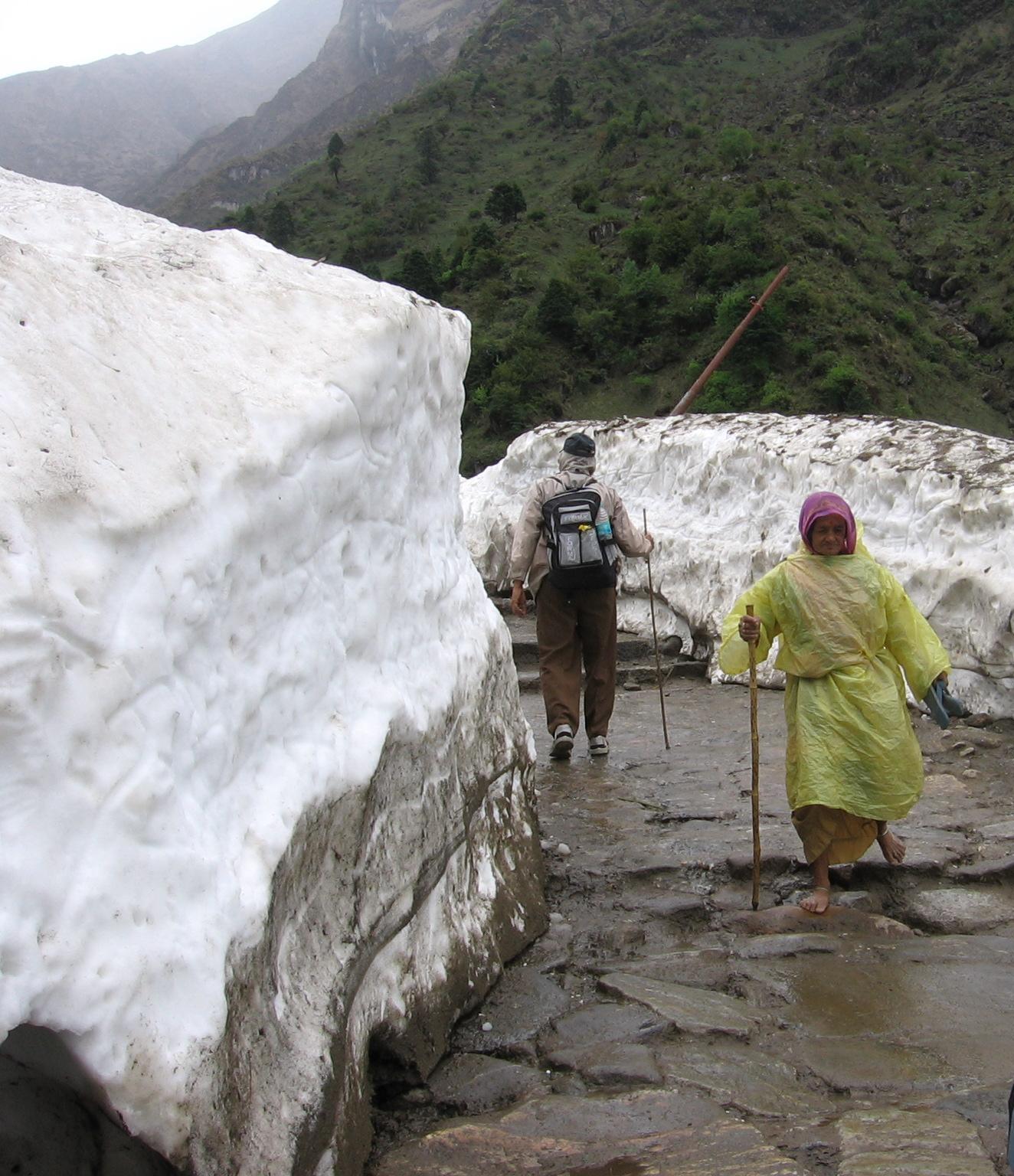
Caption: Between Snow walls at Ramwada
With heavy snowfall in winter and roads being blocked with some 10’ of snow, the snow cutters were used to make a pathway way for the trekkers to walk between two ice walls. A drizzle in afternoon is very common in these regions and poncho (cheap raincoat) is really handy for the Yatris. 


Image 5
Caption: Nature’s largesse
Mother nature poured its largesse rather liberally with huge tract of hill slope covered with snow. With the advent of summer the snow gets crystallized and hardens forming a slippery surface. However that did not deter the villagers frolicking on the white surface. Sheep are perched on rocks in the foreground.


Image 6
Caption: Glacial lake – Gandhi Sarovar
For the adventure seeking yatris to Kedar, there is a 3.5 km trek further up the hill to reach Gandhi Sarovar (Chorabari Tal) at the snout of Chorabari glacier. When we reached the bowl shaped valley, the place was almost completely snow bound revealing a small portion of the glacial lake.


Image 7
Caption: Kedarnath peak
From the Gandhi Sarovar, the Kedarnath peak (also called Kedar massif) appeared quite near as if we could touch it. The bright sun lit day made the visual worthy for capture with a deep blue sky background.


Image 8
Caption: All concentration
Trekking on snow on mountain slopes is best attempted before sunrise. What we could do easily on our onward trek to Gandhi Sarovar through snow before sunrise became an ordeal on our return trek when sun shone real bright. The upper surface of snow melting, negotiating the slippery surface required great deal of concentration to retain the foothold. 


Image 9
Caption: Massive back drop
Yatris commencing their return trek from Kedarnath give a dimension to magnificent Kedarnath peak as a huge back drop. The downhill trek of 14 km is completed in 4 to 5 hours.


Image 10
Caption: Mt. Shivling
Some yatris to Himalayan shrine of Gangotri take to the trek of Gaumukh – source of river Ganges. After almost 7 km of trek and arriving near Cheerwasa, the Himalayan peak of Shivling bathed in morning sunlight and caressed by sparse clouds is a visual delight.


Image 11
Caption: Bhagirathi Massif
As trekkers reach nearer to Gaumukh, the Bhagirathi peak looms larger. The trek route, totally barren and full of stones and boulders of various sizes, last few km is the toughest. The river itself is a small flowing stream, gray in color full of silt.   


Image 12
Caption: Snow-view from Tunganath
Tunganath is one of the Panch Kedar shrines in Garhwal Himlayas at 12,500’ elevation. The 4 km trek through steep gradient stone stitched path starts from Chopta. With clouds lifting its veil and making Himalayan panorama visible after a bout of rain and hail storm.


Image 13 Caption: Snow-peak from Madmaheshwar
Madmaheshwar is one of the Panch Kedar shrines in Garhwal Himalayas. After a bout of snowfall and rainfall in the religious town, the snow-peak make its gorgeous appearance above the cottages scattered around the temple. 

 
Image 14 Caption: Snow-view from Panar Bugyal
Rudranath is one of the Panch Kedar shrines in Garhwal Himalayas. The three and a half days trek from Sagar gives a first night halt at Panar Bugyal ( green meadow ). The snow view in early morning as the yatris come out of their cottage on to the Bugyal is all nature in its pristine glory.


Image 15
Caption: Kedar peak view from Ukhimath
Ukhimath will rank as one of the finest Garhwal destinations. The low altitude makes it a round the year visiting place and gives some of the finest views of Himalayan peaks  like Chaukhamba and Kedar. The following frame was captured from Ukhimath market making way behind the row of shops facing the hgill side.


Image 16
Caption: Mt. Nandadevi view from Auli
Auli is famous skiing resort which one can approach via ropeway or drive a 14 km asphalted road from Joshinath. In summer the panorama of Himalayan peaks is the best attraction for tourists.
The tallest peak is Mt. Nandadevi quite conspicuous by its presence among the lesser peaks.  


Image 17
Caption: Above the snowline
Sri Hemkunt Sahib yatra begins in first week of June after the snow along the trek route of 7 km from Ghangaria is cleared. The yatra is tough but one is rewarded with some of the finest snowscapes he will ever see.


Image 18
Caption: Panchchuli Himalayan peaks
Panchchuli is the formation of five Himalayan peaks in one row and is perhaps seen best from Munshiyari the town in Kumaon region of Uttarakhand.


Image 19
Caption: Tallest of Panchchuli peaks
A close-up of the tallest among Panchchuli peak gives a classic pyramid look in a azure blue sky back drop.


Image 20
Caption: Snow peaks at Binsar
Binsar Wildlife sanctuary is a multifaceted destination in Kumaon region of Uttarakahnd. The end to end panorama of Himalayan range is most enjoyable during sunrise. One gets a simultaneous vision of rising sun and spreading of the golden glow on snowpeaks. 

................................................................................................